The geography
Georgia is comfortably ensconced alongside the east coast of the Black Sea. The country is pampered by the warm and pleasant climate provided under the protection of the Greater Caucasus mountains.
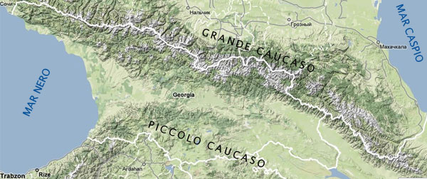
Standing graciously along the entire northern perimeter to ricochet a cold weather from Russia these magnificent mountains, a domain of picturesque perennial glaciers, verdant alpine meadows, hulking evergreen forests, scattered historic villages with medieval fortresses, and unique wildlife, are tallest in Europe.
On the other hand, the Lesser Caucasus mountains located on the southern part of the country, although modest in height, are luscious and multifaceted alike. They secure this nation against the arid climate found in most parts of Turkey, Azerbaijan and Armenia _ southern neighbors of Georgia.
All four European seasons are so meticulously observed in Georgia that a single day can make a huge difference.
There are a plethora of rivers meandering throughout the country, with Mtkvari on the East and Rioni on the West being the largest. Lakes and glaciers are other beauties available in the mountains. The subtropics along the Black Sea harvest in lemons, oranges and tea and the rather dry eastern part of the country is renowned for its vineyards and fine wine.
Borders
Georgia is bordered on the north by Russian Federation (723 Km), on the west by the Black Sea (310 km cost), on the south by Turkey (252 Km), Armenia (164 Km) and Azerbaijan, on the east by Azerbaijan.
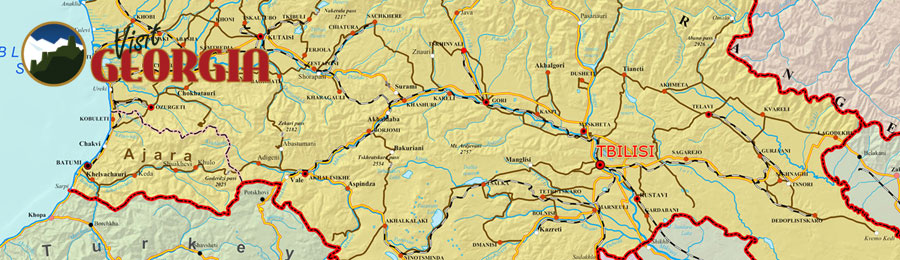
Main Cities
Georgian main cities are: Tbilisi (the Capital), Kutaisi, Batumi, Gori, Telavi and Rustavi.
|
 |